 vesseltracker.com
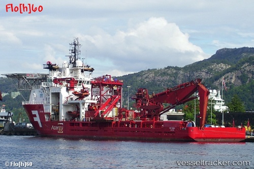
Vessel OCEANICASUB VI IMO: 9237955, MMSI: 232039060 Offshore Support Vessel
UTC, -22.63736, -40.09044, course: -1, speed: 0.1
UTC, -22.63731, -40.09044, course: -1, speed: 0.2
2026-01-27 07:39:34 UTC, -22.69833, -40.37167, course: -1, speed: 7
Live AIS position:
UTC. Near Fluminense FPSO),
updated 2026-01-27 07:39:34 UTC.
Find the position of the vessel OCEANICASUB VI on the map. The latter are known coordinates and path.
marine traffic ship tracker show on live map
The current position of vessel OCEANICASUB VI is -22.69833 lat / -40.37167 lng. Updated: 2026-01-27 07:39:34 UTCCurrently sailing under the flag of Isle of Man
OCEANICASUB VI built in 2001 year
Deadweight:
4680 tDetails:
Last coordinates of the vessel:
UTC, -22.63730, -40.09044, course: -1, speed: 0.1UTC, -22.63736, -40.09044, course: -1, speed: 0.1
UTC, -22.63731, -40.09044, course: -1, speed: 0.2
2026-01-27 07:39:34 UTC, -22.69833, -40.37167, course: -1, speed: 7